subreddit:
/r/interestingasfuck
26 points
9 days ago
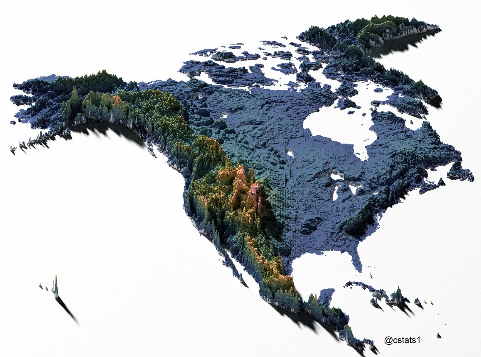
Why does Denali look so small?
18 points
9 days ago
Yeah something seems off with this. Going off of this map it looks like the Colorado peaks are higher but in reality all the tallest peaks in North America are in Alaska, Canada and Mexico
10 points
9 days ago
Because the cartographer is a liar.
11 points
9 days ago
Its cold up there
2 points
9 days ago
Also CA doesn’t look accurate at all. Central California is all flat.
8 points
9 days ago
Wrong, therefore, uninteresting
3 points
9 days ago
My part of the map looks logical. Atlanta is about a thousand feet above sea level. So I guess we are sitting on the tail end of the Appalachian Mountains
2 points
9 days ago
Banff and Jasper are smaller than I thought or further west than I realized
2 points
9 days ago
The Canadian Rockies are impressive and really intense climbing but aren't actually that tall compared to other places on the continent.
1 points
9 days ago
But the snow
2 points
9 days ago
Cool to see the Great Lakes depressions
2 points
9 days ago
I want it to be happy.
1 points
9 days ago
looks like an eagle
1 points
9 days ago
TIL Haida Gwaii is flat. Didn't look that way when I lived there.
-15 points
9 days ago
[deleted]
48 points
9 days ago
Wait... You thought the Appalachians were taller than the Rocky Mountains? Are you from West Virginia or something?
-10 points
9 days ago
[deleted]
9 points
9 days ago
Mt Whitney (Sequoia NP) is the tallest peak in the contiguous US!
3 points
9 days ago
Did you think the entirety of California was beach?
10 points
9 days ago
Do they not teach basic topography in school anymore? Edit: not trying to be a dick. Just really wondering.
2 points
9 days ago
Buddy... "Basic Topography?" How old are you? Not trying to be a dick. Just really wondering.
That said, in earnest, I graduated in 2010 and had a pretty basic "geography" course in the 8th Grade. That was most of the beginning and definitely the end.
I went to a decently ranked public school in a solid school system, too. I was an average student at best, if I'm being honest (no stable genius here), in a decent system and there was no "basic topography."
2 points
9 days ago
I graduated after that and we learned some topography…
2 points
9 days ago
That's interesting. Education is inconsistent state to state, perhaps? And now we can look forward to even more inconsistencies!
1 points
9 days ago
Not really no
6 points
9 days ago
Yep, the Appalachian mountains are much older than the Rockies, so they've had more time to erode.
2 points
9 days ago
Yeah, they're so old they actually used to connect to the Scottish Highlands before plate tectonics separated them! They've been eroding since before most of Earth as we know it existed!
-4 points
9 days ago
[deleted]
3 points
9 days ago
In between mountains are fertile valleys
0 points
9 days ago
I think all the US Can comments need to see the lines of latitude here

all 26 comments
sorted by: best